Hyalite to South Cottonwood Trail Bozeman Montana.

The Hyalite to South Cottonwood Trail is a real Jekyll & Hyde Trail, definitely not a trail for the cocky gung-ho riders, and definitely not a trail to test your $89 full suspension Walmart Mongoose.

But, if you are up for a scary challenge then this trail is definitely the dogs bollocks!!

Hyalite to South Cottonwood Trail Bozeman Montana

Trail Stats & Information

Nearby City: Bozeman

Length: 11.4 miles

Trail Type: Point 2 Point, or loop ( for loop add about 14 miles )

Skill Level: Technically very difficult. Physically difficult.

Duration: 3-4 hours

Trailhead Elev: 6,600 feet

Top Elev: 7,920 feet

Book Description

The History Rock trail almost immediately begins a 3 mile climb out of the parking lot. The first 1/2 mile is a good warmup before it becomes steep and sustained for about 2 miles to a junction. This is all cleanable, but will definetly get your heart pumping. Once you reach a meadow with beautiful views of Mt. Blackmore, you know you are done climbing, from here on it is downhill.
Technical switchbacks, rocks and roots will make this a terrifying ride.

My Experience

Traihead was easy to find, it was well marked easy to follow. The first 20 minutes on the History Rock Trail was easy going, and I was pretty confident I would manage to reach the top without stopping.. 10 minutes past History Rock and I was walking!! and I probably spent 10-15 walking, this trail was killin’ me!!.

The strange thing about this trail, is it looks and feels easy, it is not overly steep, the trail is in good shape, not rocky or many roots, but that was just deceiving!!.. I am a fairly decent climber, but you would have to come from a very good stable to make it to the top of this one without stopping and walking.

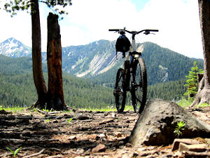
Once at the top, it all opens up to a mountain meadow with stunning views, and right there in front of you, is a beautiful very narrow singletrack dropping down as far as you can see.. I am not much of a poet, but when I saw that I almost became one!

I was off like a greased whippet screaming down the smooth singletrack, just as I was hitting take off speed, the trail became rocky, and I was up & down like Bangkok Betty still going too fast, then out of nowhere a 130 degree switchback was in front of me. Don’t ask me how I did it, but I managed to get around it in one piece, but I had been warned, this trail is not to be taken lightly. The 5 miles that followed were darn right abusive and pretty scary, absolutely zero room for error, if you fall on this trail, you are gonna have some serious bacon… and that’s if you’re lucky, this is definitely not a trail you want to fall off your steed. Uncomfortable with large rocks and tech switchbacks?.. how about a 3 foot fall on a switchback? thank the lord I saw it on time and managed to come to a safe stop, ‘cos if you Endo here, you are gonna have 5 seconds to learn how to fly, or get hurt very badly..

This is a fantastic trail, but to fully enjoy it you have to remember 2 very important things.. Go too fast and you are gonna get seriously hurt, and go too slow and you will get seriously hurt

Treat this trail with respect and don’t forget to thank the ” Trail Guardian” if you make it down in one piece.

Conclusion

Great Trail with a high buzz factor and some great views, really sweet singletrack. The climb is physically very demanding, and the downhill is pretty abusive and technical

Other Info:

Traffic on Trail : no one untill the last mile from the Cottonwood TH

Wild Life : too tired to notice while climbing, and too much concentration on the downhill to notice

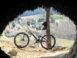
Scenery : Some very scenic stretches

Other : Just be very careful and Good Luck

My Trail Rating : 8.5 / 10

.

.

Mountain biking in the Dordogne

The Vezere Valley in the Dordogne, a region in South West France is the undisputed Prehistoric Capital of the World, and the place our Prehistoric Ancestors called home more than 460000 years ago.

Mountain biking in the Dordogne offers a unique experience, offering mountain bikers miles of trails that takes the rider through stunning ancient scenery, riddled with caves, shelters, overhangs, troglodytes, ruins and stunning views. The trails in the Dordogne are probably the oldest trails in the world.

In the past 5 years, the  Dordogne has  spent a lot of time and money clearing, marking and connecting hundreds of trails, creating a fantastic, well marked  trail system. The downside is, that maps and / or trail books for mountain biking are non existent.

Walking Dordogne, is owned and run by “Duke” who I met a few years ago in Fruita and then again in Moab. Walking Dordogne launched Mountain Biking Dordogne, and they offer without any doubt the finest and most unique mtb trails in the Dordogne. Mountain Biking Dordogne have combined the best trails, linking them together creating a trail network  that is second to none.

Quote from Mountain Biking Dordogne

We have spent the past 3 years creating a handful of Mountain Biking Trails, that have become the best trails in the Dordogne … Now we have taken another big step and have linked all our trails to create the fantastic an unique ” Neanderthals Revenge”.
Unlimited kilometers of off road trails giving every mountain biker an unforgettable experience.
Caves, shelters, troglodytes, medieval ruins, singletracks, downhills and lots more.
Without any doubt the best and most unique trail in the South West France.

I stayed at the beautiful 1000 year old B&B Ferme de Tayac while I did the trails in the Dordogne, and most trails actually leave from here.
Neanderthals Revenge is actually 3 completely different loops, connect to each other by other trails. This means that Neanderthals Revenge can be done from any direction, and can be as long as you choose.

Neanderthals Revenge Vezere Valley Dordogne

The trail option I went for was clockwise, and started with a scenic easy climb through the medieval hamlet of Tayac, but after just 3 minutes disappeared onto a singletrack into the woods. The following 20 minutes is climbing up an ancient very rocky track. The track levels out slightly and takes you onto a dirt double track for another mile. A singletrack on the right quickly drops off, this is the trail you have to take, so make sure your gears are out of granny and you are prepared for a fast bumpy, slippery and grade 3 technical downhill.. choose your comfortable speed and your path, and stick to it, be easy on the brakes, ‘cos this is a “slip & slide” section.

The trail takes you down to a road, that you must follow for 2 minutes to continue  off road. Ride over the bridge, and make an immediate left down the steep short path that leads to the river, continue past the canoe outfitter and follow the river for about 2 miles.. Cross a railway line, and take an immediate left and follow the double track for a few miles, passing a very picturesque  medieval hub of  houses. The trail leads to a rural road that you will have to follow for a few miles.. This road is a steep climb, taking you to the top, so keep telling yourself that you will soon be on a long sweet downhill singletrack.
The downhill is fast and fun, somewhat rocky, but technically a grade 2, however, there is little room for error at these potential high speeds.

The smile on your face will soon disappear, ‘cos you bottom out to a long and tiring climb, the good news is, you are nearing “Hells Gorge”
Hells Gorge is just under 2 miles, but believe me, it is steep, extremely fast, slippery as an eel in a bucket of snot, rocky, bumpy, blind spots and it bottoms out onto a busy road. Being Gung Ho on Hells Gorge is definitely not a good idea, and I suggest you do a “Granny Run” before you attempt this section… don’t get me wrong, Hells Gorge is not a technical run, as in “Technical” but due to a combination of all the above, it is a very demanding section, with zero room for any errors.


Two loops down, one more to do, and without doubt, we have saved the best and most unique for last. This is also by far the most technical section of Neanderthals Revenge. Anyone not comfortable with heights, and very narrow sections with extreme drop-offs should avoid this loop, or contact Mountain Biking Dordogne for an alternative section of this loop.

This section of trail is just mental, both physically  and mentally, and you will spend some time walking your steed, sometimes ‘cos because you have to, and sometimes ‘cos you’ll prefer to.

I have done 100’s of trails worldwide, but never anything like this.. I was told to make sure I had flashlights fixed in the bike, but I did not realize I would be disappearing into caves!! Some sections of this trail takes you on a 4ft rock ledge with a 60ft sheer drop.. definitely not for the faint hearted.
Once you’ve topped out, you’ll spend a few fast miles on some fun singletrack that takes you to the final downhill section..
This section is an adrenalin rush, narrow singletrack that dives down through the forest, dodging the trees. You will feel like you are part of an extremely fast video game, you need to plan at least 3 trees ahead, cos the come at you out of nowhere.. There are 2 very short but grade 4 tech. spots on this section.

About 3 hours after I left, I finished this trail with a huge smile on my chops, thankful that I made it in one piece and still on my steed… I had conquered Neanderthals Revenge!!!
.

.

.

.

My first time riding in the Bozeman & Big Sky area. Arrived on another glorious sunny day, set up camp and headed straight to the bike shop for a map and advice. There are plenty of trails to choose from in this area, but I quickly opted for the Bangtail Divide Trail.
So, did this first Bozeman trail impress me? or was it a big disappointment?

Bangtail divide Trail

Trail Stats & Information

Nearby City: Bozeman

Length: 23.8 miles

Trail Type: Point to Point with shuttle or loop [ for loop add 8 miles to total length ]

Skill Level: Aerobically: strenuous; Technically: easy

Duration: 4-6 hours

Trailhead Elev: 5,560 feet

Top Elev: 7,950 feet

Book Description

A relatively new trail to the area, the Baingtail Divide trail was completed in 2003. The trail spans from the Brackett Creek Trailhead to Stone Creek for a total of approximately 23.8 miles. The trail is well built and hardly technical, but due to the length, is considered an intermediate trail.
Built with bikers in mind, the trail has excellent descents on both ends of the trail with a couple big grassy meadows that provide a great view of several mountain ranges to include the Briders, Crazies, Absaroka, Gallatin, and Madison.
There are several different ways to ride the trail. You can car shuttle from one end to the other, you can ride it as a loop if you add about 7 or 8 miles of highway riding, or you can ride it in sections by using Olson Road which puts you onto the southern part of the northern 1/3 of the trail. The most common choice is to ride from the southern to north (Stone Creek to Brackett Creek)

My Experience

Trailhead is easy to find, the trail is well marked. There is a lot of climbing on this trail, but it is definitely doable, just put your steed into low gear, switch off , and enjoy the climb. This trail is in my books technically easy, but it is a long ride and a long walk out if anything goes wrong, so go well prepared. I did this trail as a P2P (point 2 point) starting at Stone Creek and finishing at Bracket Creek, however this trail can be done from both directions.

Conclusion

Oooohhh yes!! this trail is what mountain biking is about, not too strenuous, 23 miles of sweet singletrack through stunning scenery. The trail is well maintained and well marked. The scenery is fantastic, and it came with the smell of fresh pine and 1000’s of wild flowers. The 2-3 hour total climb is rewarded with a fantastic smooth downhill with in most places more than enough visibility to open up to a fair speed.. Don’t open up too much, cos there are a few very tight switchbacks that appear out of nowhere, and some have some pretty brutal drops that you definitely don’t want to hit going too fast.. If this trail doesn’t put a smile on your chops, then nothing will!

All in all, the Bangtail Divide Trail is a definite “Must Ride Trail”.. I did this one in 4 hours 29 min. and I enjoyed every second of both the riding and the scenery.

Other Info:

Traffic on Trail : 5 mountain bikers, one jogger, one hiker

Wild Life : I did not see anything

Scenery : 23 miles of scenery

Other : Take extra fluids, don’t forget the bug repellent there are ( were) lots of pesky horseflies.

My Trail Rating : 9.5 / 10


.


.