Downieville Classic

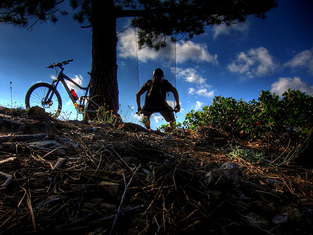
Enjoying the early morning views on the Downieville Classic


For years now I have been hearing lots of fantastic stories about the Downieville Trails. I almost made it here last year, but the South Lake Tahoe Trails kept me occupied longer than planned, so I never made it. As I’m sure you can understand, I was pretty stoked about riding what a lot of people call “The hottest mtb destination in the USA” .. I have been to a lot of fantastic mtb destinations, and was really curious if Downieville would come close to some of my all time favorites, or would it go down as Just OK …


Downieville Classic Trail Map
.

Trail Stats & Information

Nearby Town : Downieville / Sierra City

Length: 21.94 mi

Trail Type: Point to Point

Skill Level: [what the books say] no info

Skill Level: [My Opinion] Technically moderate – challenging. Physically demanding.

Duration : My time was 04:31:17

Elev Gain: 3,907 ft

Top Elev : 5,177 ft

Min. Elev : 2,886 ft

.

Book Description

The trail begins with an 8 mile, 3,000′ climb up the face of the Sierra Buttes, a metamorphic crown that stretches 8,600′ towards the wide-open sky. This legendary climb is known to many as the “Trail of Tears”. It starts with pavement, turns to dirt, and then gradually steepens and narrows to a loose, exposed, shaly doubletrack. We try to make things more comfortable by providing an overhead water mister at the 2 mile point, and Clif Bar supported aid stations at the 4 and 7 mile markers.
After cresting the saddle, the route follows a rolling jeep road to the east rim of Gold Valley and the top of “Baby Heads” – a fast, loose, rocky descent that is responsible for numerous flat tires, get-offs and lead changes. At the bottom of this anarchy awaits Gold Valley and the Pauley Creek crossing. This 30′ wide crossing can be as deep as 3′ during the race, often making it difficult to navigate across at high-speed.
Once across, the route turns to singletrack on the Pauley Creek Trail, a 17 mile creekside plunge that blends flowing turns and rolling jumps with jagged rocks and slippery roots. After descending 2,000′ and crossing three foot-bridges, the trail climbs from the Pauley Creek Canyon to the Lavezzola Creek Canyon, and to the trailhead of the world famous Third Divide Trail. Third Divide is known for it’s Star Wars like speeds, magic carpet tread, bermed corners and lofty airs.
After a thrilling 3 miles, Third Divide Trail dumps out onto Lavezzola Road, which descends to the upper First Divide trail, a 150 year-old water flume built to provide water to a nearby hydraulic mining site. This stretch of trail requires a ton of pedaling as it winds its way downstream through the Lavezzola Creek Canyon, across a saddle, and into the Pauley Creek Canyon to the long awaited streets of downtown Downieville for the finish.


My Experience

I decided for numerous reasons to base myself in Sierra City, just 10 miles from Downieville, and the actual start of the Downieville Classic. As usual I arrived without any maps, and with very limited trail intel. Lucky for me I arrived on a Sunday, and the last day of the Downieville Classic Race, which meant that about 900 mountain bikers had just ridden the trail, thus making it very easy for me to follow… Yeah!.. well that was my plan anyway.
So, very early on a very sunny Tuesday morning I set off with my very basic map, but my excellent plan to follow the well ridden trail.
I knew I had an 8 mile solid climb, but for some reason known to nobody, I kinda forgot how far 8 miles is when it’s all uphill, with zero shelter from the sun. The scary thing about the first 4 miles, is that you can actually see for almost 4 miles the trail you will be taking, and believe me, it’s a longgg climb.
The first 4 miles was a grunt, but at least you can’t go wrong.. this changes when you think you have reached the top, and you suddenly find yourself at a 4 way Trail junction.. that is NOT on the map, and all 4 directions are very well worn.. So, it was decision time, I had come from one direction, so I had a choice of 3 others, Left, Straight Ahead or Right… I decided to go left ( direction Downieville ) luckily for me, the trail dead ended after a mile, so that was an easy decision to return to the junction. My next guess.. Straight Ahead… Not quite lucky this time, the trail ran into a “Wall of Snow” 3 miles DOWN the trail, so I knew this was not the right way either.. So it was the Right Trail I had to take.
From the 4 mile mark, the trail continues to climb for another 4 miles, but nowhere near as bad as the first 4 mile climb. Once you hit the tarmac it’s a mile downhill to the ” Butcher Ranch Trail”…
Now this is the Starting Point to your Reward for the 8 mile climb.. And what a Reward it is..
The next 13 miles is 100% fun pumping fast manic and raw Mayhem!! .. I have not got a clue what was going on around me, all I saw was what was directly in front of me.. going by FAST!!
I was only 10 min. into the 13 miles downhill, and I was already making plans to come back and do this again!
Although this trail offers the max enjoyment level, and it is not extremely difficult, it really should be done with caution, I felt completely at home on this trails, but if you not like very rocky narrow trails with deadly drops, it could be very scary. There are sections on this trail, that will kill you if you fall, we are not talking the 200ft sheer drops that certain Moab Trails offer, but we are talking 30 ft sheer drops into the cold rapids of the Yuba River!..


Conclusion

I have to admit, this trail really is Kick Ass.. and YES, it probably has the highest adrenalin pumpin’ fun factor of all the trails I’ve been on ( joint 1st spot with Cold Creek to Star Lake to Armstrong Pass down Corral Trail in South Lake Tahoe )

The flow and speed on this trail is amazing, kudos to the Downieville trail builders for doing such an amazing job.
There are two ways of doing this Trail, one one I did, with a brutal 8 mile climb, or the easy way, getting a shuttle to drop you off, so all you have to look forward to is the sweetest 13 miles you might ever experience..


Other Info:

Traffic on Trail: I did this ride twice, and both times I had the trail to myself, however if you get caught on the trail between “shuttles” it might be a completely different story..

Wild Life : I would not have a clue.. Way too much fun to notice wildlife

Scenery : Great scenery

Getting There : From Downieville head towards Sierra Cityon the 49. The trail starts on the Sierra Buttes Road

Other : This downhill trail can be extremely fast, however it is shared with hikers and motocrosser’s always be on the lookout for other trail users.


My Trail Rating : 10 / 10 with a GOLD STAR


The Downieville Classic was proudly sponsored by :

Yuba Expeditions Downieville

Yuba Expeditions is the one stop bike shop in Downieville, For SALES • SERVICE • DEMOS • SHUTTLES • MAPS • SEMI-ORGANIZED ANARCHY and lots more.

Yuba Expeditions is THE place to get all the up to date trail intel, as well as any parts you or your steed will need while in Downieville.

Yuba Expeditions is also the choice shuttle service of Mountain Bike Mayhem, High on Mountain Biking and Mountain Bike Trails USA.


Yuba Expeditions – Downieville Downhill
208 Main Street, Downieville CA 95936
Tel: (530) 289 3010
www.yubaexpeditions.com


10% discount


Mention MOUNTAIN BIKE MAYHEM and receive 10% discount on the Shuttle Service.


.

.

.

Case Mountain Trails - Three Rivers - California

Case Mountain Trails - Three Rivers - California


These trails came as a complete and pleasant surprise to me, I had never heard of these trails, and was here to visit the Sequoias on my way to Downieville. The Case Mountain Trails are about 3 miles from Three Rivers.
These trails were described to me as ” Like the Downieville Trails were before they became popular” .. Well in that case I was at the right place..

Trail Stats & Information

Nearby Town : Three Rivers
Length: 12.07 miles
Trail Type: Loop
Skill Level: [what the books say] no info
Skill Level: [My Opinion] Technically moderate. Physically moderate.
Duration
: My time was 03:57:57
Elev Gain
: 2.975 feet
Top Elev : 2,788 feet
Min. Elev : 979 feet


Book Description
 
I could not find any Mtb Trail books describing the Case Mountain Trails, so the below descriptions are based on my personal experience :
>> The Case Mountain Trails are riddled with fantastic singletracks. The area is not huge, but you can easily spend a day connecting these trails. One thing, these trails are NOT marked, and there are no maps available. I was very lucky to find a local ( Kevin from Three Rivers Hideaway) that was willing to get up at 6 am and show me the layout, and explain the possibilities. The trails here are sweeeet, but hard to know which ones to take.


My Experience

As I mentioned above, this whole area came as a pleasant surprise, I had not done any research at all, and had no plans to ride. While at the Three Rivers Hideaway Campground I noticed two nice looking Steeds, I asked at the office who they belonged to, and the rest is history. Kevin the owner of the steeds suggested we get an early ride in before it got too hot, the next day at 6 am we were on our way. Once on the trails we spent the first 20 min. on a sweet singletrack on one of the very few named Trails, this one was “Old Number One” the climb was gradual and easy, and it took us back onto a Fire Road. I could see 10’s of singletracks veering off in every direction, Kevin spent a great deal of time explaining each trail, cos a couple of days later I would be on my own.
We followed the fire road for about a good 30 min. all uphill, but nothing too serious. While climbing you will notice the very fast flowing singletracks to each side of the road .. These are trails that will be taking you back down.. FAST!!
We finally made it to the point where we had to prepare ourselves for the mayhem ride back down, all and only on sweet singletrack.
The descent was fast and fun, and I did not do too bad with keeping up with Kevin. I do confess that I did quite a spectacular Endo, luckily no serious damage done.
The downhill is really fast, and narrow, and there is zero room for any hesitation. All in all FANTASTIC!
2 days later I went back on my own and did the Trail that came highly recommended by Kevin, same kind of trail I did above, just higher and about 6 miles longer.. Again, it was fast and furious and a good 6 miles of sweet singletrack.
I wish I had more time to explore these trails, I will definitely be back one of these days to try the so many trails I did not manage to ride.


Conclusion
These trails really are sweet, and you are almost guaranteed the trails to yourself. They are however surprisingly well maintained by the local Mtb’ers ( Kudos to them for doing such a great job) Also, what is pretty nice, is that you can reach the High Spots by following the fire road, but 100% of the downhill is miles singletrack.
The downside is, the trails are not marked or mapped, making it very difficult for outsiders to know what the best routes are.. , but maybe this is a good thing!. I was lucky I had a guide that explained the layout to me.
Bottom line is, if you are ever near Three Rivers, you would be mad not to hit the Case Mountain Trails


Other Info:

Traffic on Trail : I had all the trails to myself, I did not see anyone.
Wild Life : King Snake and a Rattlesnake ( huge)
Scenery : Great scenery
Getting There : From Three Rivers continue about 4 miles along the 198 towards Hammond. Just past Three Rivers Hideaway (on the left) take a right at the church up Skyline Dr. Follow Skyline all the way to the Trailhead ( do not veer off of Skyline)
Other : Take sun lotion and extra fluids, in the summer it can get hot ( 104 when I was there )


My Trail Rating : 8.5 / 10


.

.

.

.